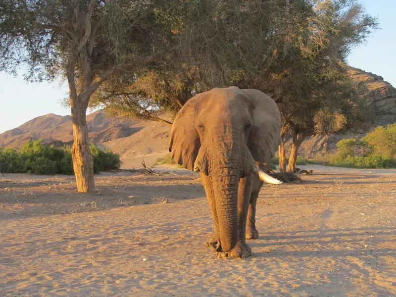
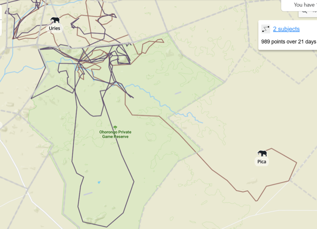
They arrive as quietly as a habit. Every few weeks, our cameras and the soft sand in Ohorongo’s riverbeds tell us the same story: elephants are back, following their old routes across north-west Namibia’s drylands.
How the elephants find us
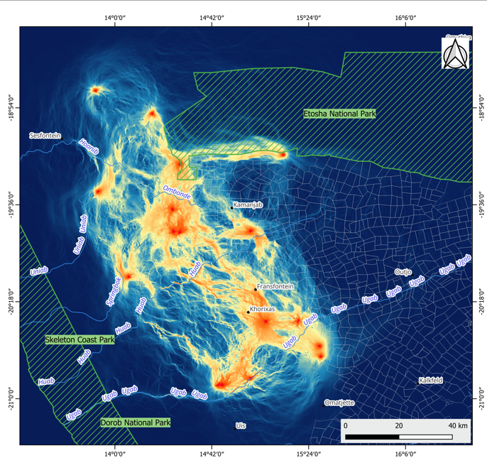
Ohorongo sits inside a larger landscape that elephants know well, stretching from the Ugab River up towards Etosha and across ERP-managed farms. Collars on matriarchs and a handful of bulls show how different herds thread through this mosaic of national park, private nature reserve, communal conservancies and commercial farms. Some, like the elephants collared in the ERP area, loop through Ohorongo as part of a wider circuit, then move on to neighbouring farms and conservancies before returning again.
Researchers are now using “circuit theory” to map these paths, treating the landscape like an electric board: riverbeds, gentle slopes and good browse conduct movement, while fences, steep slopes and villages resist it. On these maps, Ohorongo and our neighbouring ERP farms glow as a strong corridor, one link in a chain that reaches from the Ugab up to Etosha.
A regular rhythm in a harsh place
In this hyper-arid savannah, survival depends on movement. Rain falls patchily, surface water shifts, and elephants respond by expanding and contracting their home ranges, sometimes covering hundreds to thousands of square kilometres over a year. The collared herds rarely stay within a single land-use type; seven of eight studied females routinely crossed between communal conservancies, commercial farms, government concessions and the Etosha system.
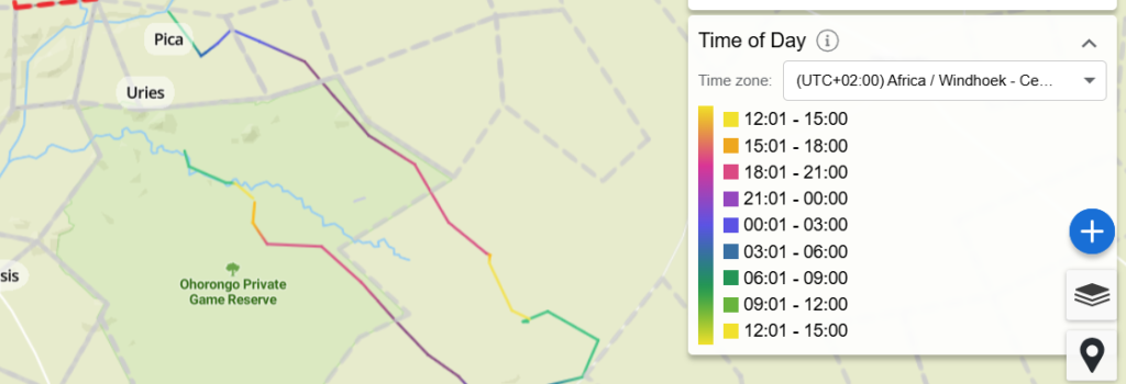
For us at Ohorongo, that means their visits now follow a recognisable rhythm. We see longer, more relaxed daytime movements while they are inside protected and conservation-focused land, then a switch to more nocturnal travel and shorter steps when they venture into unprotected farming areas. They often arrive along the same riparian lines, rest and feed in familiar groves, then slip out through the same low points in fence lines that they and other wildlife have used before.
Fences, conflicts and new opportunities
Each elephant visit also crosses invisible lines on a policy map. Collars have recorded more than a thousand fence breaches in a year across the wider landscape, including repeated damage to the national Veterinary Cordon Fence as elephants push south in search of forage and water. When they move from Etosha into private land or between commercial and communal farms, they don’t just blur ecological boundaries; they trigger legal questions about disease control, wildlife ownership and responsibility for damage.
Yet this same movement has begun to shift thinking on the ground. Around us, some farmers are pivoting away from purely cattle operations towards tourism, trophy hunting and mixed wildlife–livestock models that see elephants as an asset rather
than a threat. In our immediate neighbourhood, ERP-supported research and land purchases are starting to stitch together farms into a more permeable sanctuary, turning the elephants’ preferred routes into deliberate corridors instead of accidental weaknesses in a fence.
What Ohorongo is learning
Living on a corridor means we cannot design Ohorongo as an island. The same elephants that linger calmly on our side may cross into less welcoming land tomorrow, and our decisions ripple far beyond our boundaries. That is why we have committed to supporting collaring, live tracking through platforms like EarthRanger, and collaborative planning with parks, conservancies and neighbouring landowners.
Over time, we hope that the “regular pattern” we see—the quiet reappearance of familiar herds—becomes the backbone of a consciously managed landscape-wide network. If policy can evolve to recognise corridors, and fencing rules adapt to smarter, more flexible systems, then elephants will keep doing what they have always done here: walking the drylands in wide, deliberate loops, pausing at places like Ohorongo that choose to make space for their return.
Sources
Morgan-Hauptfleisch of the Namibian Nature Foundation Q3 Elephant Quarterly 20251212-35
“Exploring implications of elephant movements between land use types in a semi-arid savannah landscape” by Morgan Hauptfleisch et al